This is the fourth post in a series on the Louisiana coastal wetlands. In the first post, I introduced you to the wetlands and talked about how they formed. In the next two posts, I discussed some of the reasons the coastal wetlands are important, both ecologically and hydrologically, and how these functions affect the economy. In this post, I’ll discuss some of the problems that Louisiana’s coastal wetlands have been subject to.
For the last 50 years, Louisiana has lost roughly 34 square miles of coastal wetland per year. This loss of 1,700 square miles represents 80% of the nation’s total wetland loss during that time.1 Estimates suggest that over the next 50 years, even with current restoration efforts factored in, Louisiana stands to lose an additional 500 to 1,000 square miles of coastal wetlands.
I’ve talked quite a bit about why the wetlands are so important in previous posts, but just to put that into perspective for you one more time, based on data from past hurricanes, some estimates indicate that the loss of every 1-mile strip of wetlands along the coast may increase property damage by as much as an average $5.7 million annually.2
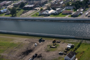
While storms and natural processes can have some effect on land loss, the major causes of Louisiana’s wetland loss are all anthropogenic, or caused by humans. This anthropogenic impact came in to full force following the Great Mississippi River Flood of 1927, the most destructive river flood in the nation’s history. The flood affected 10 states, broke existing levee systems in 145 places, and killed 246 people. In some places, the river swelled to 60 miles in width and inundated land up to a depth of 30 feet. Following this disaster, intense public outcry arose for a larger and more comprehensive levee and flood control system. As explained by America’s Wetland Foundation:
The ensuing years would see a complex system of locks and dams built by the federal government, trapping sediment, withholding valuable land building resources and starving the natural process of nutrients and sediments that would limit building the Delta. … The federal government also built jetties at the river’s mouth to carry the sediments out over the Outer Continental Shelf. The idea was that natural scouring would help maintain this critical navigation corridor. The result is that about 160 million tons of sediment are jettisoned off the continental shelf and lost into the depths of the Gulf of Mexico each year.3
This channelization marked the end of a cycle that has flowed unabated for thousands of years. The coastal land continued to subside and erode, but it was not being replenished and nourished by annual floods and sediment deposits. It did not take long for the wetlands to start disappearing.
The problem was exacerbated by dredging a latticework of canals through the coastal wetlands. From the 1960s through the 1980s, oil and gas companies dramatically expanded these networks for exploration and transportation. These canals gradually widen due to wave action and allow even more water into the wetlands. The wetlands eventually drown or become poisoned with saltwater incursion. As the wetland vegetation dies off, roots no longer hold the sediment in place, and the land quickly erodes and gives way to open water. Southern Louisiana is now one of the most intensively engineered places in the nation, with nearly all efforts bent toward navigation and an illusion of flood control.
According to the U.S. Geological Survey (USGS), “Louisiana’s 3 million acres of wetlands are lost at the rate [of] about 75 square kilometers annually, but reducing these losses is proving to be difficult and costly.”4 However, wetlands are a valuable asset, and federal and state governments have implemented many laws that help protect the wetlands. The next post in this series will introduce some of the remedies in place if one damages these valuable lands.


Recent Comments